
Creating a zone / area map can help save the amount of time and labor needed to create a permaculture system. This map helps show how to combine elements / elements that suit your needs.
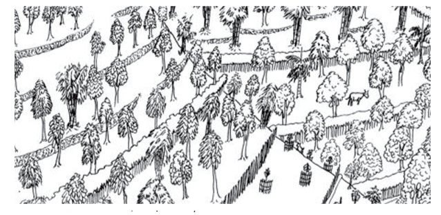
To make a map of the area, you can see agriculture in five zones, where the zone starts at home.
Each zone represents a different region in the system. The elements are placed in each zone, depending on:
• How often the elements are visited - Zone 1 which most often gets to zone 5 which is the least frequent.
• How much maintenance is needed - Zone 1 is the most up to zone 5 which is the least. • Access to water supply - Zone 1 which requires the most water access to zone 5 that requires the least.
• Required land area / area - Zone 1 which requires the smallest land to zone 5 which is the widest.
• Compliance with land - Compliance with other elements in the vicinity.
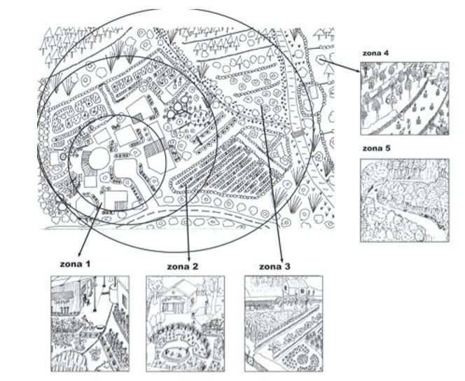
Zone 1: Home Garden
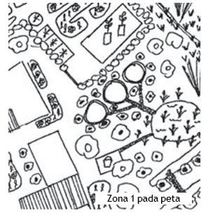
Zone 1 is the environment closest to our home. In zone 1, we place whatever needs the most attention and care, as well as providing daily home needs. These include:
• Home, kitchen, bathroom, WC.
• Nursery.
• Fences and vines.
• Home gardens, pharmacies and living kitchens.
• Fruit trees and shade.
• Water pump.
• Compost.
• Water reservoirs.
• Waste collection ponds.
• Aquaculture (ponds).
• Small farms.
If you have elements in zone 1, the important thing is to put them together as well as possible.
Shady plants are good for the home, but too much shade for vegetable beds can reduce yield.
Water pumps should be far away from toilets, so as not to be contaminated with toilet waste.
Para-vines for vines can be made to shade the house, it can create a cool atmosphere. For hot areas, it can be placed in the west, and cold regions can be placed in the east. The house remains cool due to reduced direct sunlight.
The elements that have the same or complementary needs, should be placed together. This will maximize results, but minimize time and effort. This concept must be used in each zone and its relationship with each other.
** Zone 2: Village**
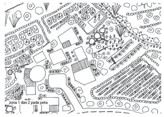
The village includes all infrastructure buildings such as roads, alleys, places of worship, schools, village land, civil offices, including residential areas.
The whole village can be built very well through the design of permaculture, which includes the following elements:
• Village nurseries can be placed in the elementary school environment.
• Roadside plants, as shade plants, animal feed, wind and dust barriers, fruits, medicine, firewood.
• Community waste management facilities.
• Clean water sources.
• Land for practice and food gardens for the community.
• The market is designed in such a way as to overcome the problem of clutter, unpleasant odors, and minimal cleanliness.
• Control of livestock by binding or with pens, so that they do not damage the home gardens and food production systems of rural communities.
The place to accommodate animals such as goats or buffaloes stay the night. This place will certainly accommodate their droppings, so that manure is easily collected.
Elements in zone 2 can also attract tourists, such as:
• Booths selling home garden products (street vendors), to attract tourists.
• Lodging huts for tourists, which can bring extra income.
• Local tourist attractions can also be exhibited.
Zone 3: Small Farms in the Rural Areas
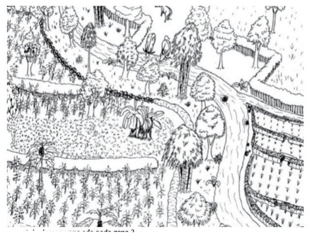
Zone 3 is a land that needs less attention and care, usually located far from the house.
The elements include:
• Permanently fenced land.
• Intercropping (mixing of plants).
• Trees and annual plants, for food supply throughout the year.
• The land is divided into sections for crop rotation and land for grazing livestock that are restricted by trees that can become animal feed.
• Swales and terraces to protect soil from erosion.
• Food crop reserves for emergencies such as famine or other disasters.
• Use of non-hybrida seeds.
• Do not use chemicals, and always rotate plants to protect the soil from nutrient crises. • Reuse organic waste in the form of compost, and stop land burning.
• Integrated Pest Management (IPM), intercropping planting to reduce pests.
• Smart design and strategy, which are proven to be better than expensive agricultural equipment.
Zone 4: Community Forest
This zone is located around the village's agricultural land.
Here the community's wealth grows and it is not permitted to burn it. Plants in this zone vary, from controlled orchards to semi-wild forests.
Zone 4 is designed and managed by the community to prevent conflict. This requires minimal maintenance and attention, in the sense that irrigation and fertilization are also minimal.
A wider area is needed for this zone, including tree crops, which if planted in zones 1, 2 and 3 will disturb other plants, which are caused by shade and root competition.
The elements in zone 4 include:
• Fruit, oil and legume crops.
• Trees for wood and firewood.
• Bamboo.
• Buffalo, cow, goat.
• Water springs.
• Coffee Garden.
• Medicinal plants.
• Rice fields, if there is enough water.
• Swales for reforestation.
• Plants for craft industry materials.
Zone 5: Protection Forest
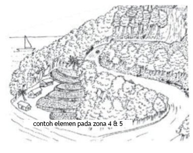
Zone 5 is an area left untouched. Natural forests provide a variety of functions such as food and medicine for humans, food and habitat for native animals, as well as protection against hunting and erosion. Protected forests can also generate money for the community while preserving it for future generations. Cutting down this forest will only produce short profits for a few people, but long-term loss and damage for many people.
Zone 5 is usually located farthest from residential areas and can be on land that is difficult to plant and manage, for example: steep slopes, eroded waterways, mountains and rocky land. Plants planted in this area should be native plants, with a variety of sizes, ages, and types.
Zone 5 includes:
• Forest protection laws that are mutually agreed upon and complied with.
• Application of ecotourism.
• Products that do not use forest wood.
• Permitting low-risk activities and prohibition of combustion.
• Forest Ranger Groups.
There are various types of situations that can affect the zones category, these include:
• Access to water. If there is access to water sources or irrigation water, the land has many possibilities for more intensive cropping systems, fruit or livestock systems.
• Access to roads. If the land has access to roads, the results will be easily transported. Therefore, the results of large plants will not be wasted.
• Level of erosion. If erosion has occurred or the soil is very steep, then the land must be stabilized by doing terracing, making swales or planting trees before intensive cultivation efforts are made.
• Soil quality. Infertile or very rocky soils will require years of labor to convert the land into arable land, or else the focus of production will be on tree crops. Usually, it is better and easier to plant first with tree crops and then slowly cultivate agricultural plants and vegetables on smaller lands. Pruning trees will help improve the cultivation area faster.